



Wartime Silk, Dragons’ Den, and the SplashMaps Story With David Overton
NOV 20, 202639 MIN
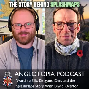
Description
David Overton is back, and this time the camera turns on his own company. SplashMaps makes rugged fabric maps — printed on the same weatherproof, washable material as high-end outdoor gear — and the story of how they came to exist runs from a boyhood love of Biggles to a promise David made himself while working at Ordnance Survey. He had watched Ordnance Survey test a fabric map and fail to sell it, and decided that when he left he would prove the idea was the future of mapping. Fourteen years on, he has. Jonathan walked all eighty-odd miles of Hadrian's Wall with one and it never let him down. They get into the engineering — why the fabric must not stretch in either direction, how you can mark one up and take the pen off with nail varnish remover — then the licensing fights with Ordnance Survey, the Dragons' Den appearance that sent sales climbing without costing him any equity, the pandemic pivot into face masks, and why a map makes a better Christmas present than a jacket nobody's sized correctly.
🗺️ OUR SPONSOR: SplashMaps
This episode is sponsored by SplashMaps — and this time the episode is the sponsor, because the story of how these maps get made is the whole conversation.
Rugged fabric maps printed on the same weatherproof, washable material as high-end outdoor gear. They shed rain, they never run out of battery, and they now have worldwide coverage including full US Geological Survey mapping, so you can get one for your own trail back home. Jonathan carried the Hadrian's Wall map the entire way across England and it was rained on more times than he can count.
Anglotopia listeners get 12% off. Enter ANGLOTOPIA at the cart — the best discount they'll run this side of Christmas, applied to all products.
Why it's a good gift: no awkward conversation about someone's height, girth or shoe size, and nothing to send back in January. Personalize a map around somewhere that matters to them, put a title at the top, and it becomes a piece of kit they'll use every time they use the rest of their gear.
👉 splash-maps.com — note the hyphen
Links
SplashMaps
SplashMaps — the hyphenated domain is the real one
Make A Map — the custom builder, anywhere in the world, with a personalized title
USA maps with USGS detail — the American offering he describes
Appalachian Trail map — designed in collaboration with National Geographic, the whole trail on one map
All long-distance trail maps — the Challenge Series is Hadrian's Wall, the Cotswold Way and the Coast to Coast, plus the four Caminos
Coast to Coast Path map
Offa's Dyke in two sectional maps: north and south
Black Friday offers — live now
Hadrian's Wall National Trail map — the one with the Anglotopia logo on it
Cotswold Way map — the trail they're both circling
Camino Inglés map — the one David holds up, with space for your stamps
Map formats — the fabric map, the Toob neck warmer, towels, scarves, wall hangings and lens cloths
The Adventure Habits Podcast — David's own show, where Jonathan appeared in June
The First David Episode
Hadrian's Wall vs. the Camino: Two Long-Distance Walkers Compare Notes — where this all started
Nick Goldsmith
Hidden Valley Bushcraft — his bushcraft business in the Chew Valley near Bristol
The hidden woodland offering a lifeline to veterans — ITV News — on his work with PTSD
Rewild Your Mind — his book
Takeaways
It began as a promise. David watched Ordnance Survey prototype a fabric map and fail to sell it, and told himself that when he left he'd take the idea and prove it was the future of mapping. Fourteen years in, he has.
The real ancestor is the wartime escape map. WWII aircrew carried silk escape and evasion maps, made partly from offcuts of parachute silk and partly from rayon, a then-new polymer derived from wood cellulose.
The fabric mustn't stretch — in either direction. That's the whole engineering constraint, because you have to be able to take a bearing off it. Neck warmers get more flexible material, and as David says, you're not taking a bearing off a neck warmer.
You can write on them and wipe it off. The print survives nail varnish remover, so you can mark a route with a semi-permanent marker and clear it afterward.
Fashion-industry printers made the best maps. After going through manufacturers across Europe, the ones who really understood textile printing turned out to be the ones who could hold the detail.
Ordnance Survey said no the first time. They thought it was gimmicky. He started with their free data, built a better mountain-biking map than they had, and they came around — he now has their premium 1:25,000 and 1:50,000 products, plus licensing with National Geographic, USGS and others.
The sea charts found a use nobody planned. Rigid inflatable lifeboats take a beating that destroys paper, so a fabric chart is the one that survives.
Dragons' Den went badly and worked anyway. Series 14, July 2016: he asked £60,000 for 15% and all five Dragons said no. The exposure did the job the investment would have, and he kept every share.
Horses think paper maps are thunder. Riders told him their horses would bolt when a paper map came out. A fabric map is near-silent.
The pandemic was two pivots, not one. First face masks — thousands of them, which helped keep the business alive through 2020 — then, when the government pushed people outdoors, a surge back into maps.
For a gift, kit beats clothing. Outdoor gear gets returned in January because sizing is a guess. A personalized map can't be the wrong size, and it gets used alongside everything else they own.
Soundbites
David, on the promise he made himself: "When I leave Ordnance Survey, I shall take that idea and I will show them that it is actually the future of mapping."
David, on where the idea really came from: "When I was a kid, my dad would read World War II stories to me... and they used silk escape and evasion maps when they bailed out of their aircraft over enemy territory. I just loved the idea from that."
David, on why people are buying now: "In the UK we actually had the government telling us that we need to stock up on tinned food and water in the last few weeks. I think that's prompted people to look at more resilience. And I think they see something resilient in the maps that we make."
David, on the one non-negotiable: "We want these to be the best maps, but without compromise. You've got to be able to take a bearing on these — therefore you can't have them stretching."
David, on the obvious question nobody asks: "You wouldn't make a rainproof jacket out of paper. That would be absolutely ridiculous. So why would you compromise with what your map's made out of? It needs to be as rugged as the adventure that you're going out on."
David, on the pushback from Ordnance Survey: "They did say no the initial time I went into them, because they didn't see how serious I was about the maps and they thought it was going to be gimmicky."
David, on the lifeboats: "They're still obliged by law to keep a physical sea chart on board. Well, guess whose is the only physical sea chart that will actually survive the beating that kind of vessel gets."
David, on Dragons' Den: "I think it was two million people came to our website... We didn't reach a settlement with the guys from the Dragons' Den, so we made all those sales without actually having to give away any equity."
David, on the masks: "People wanted to have their own identity, or to choose their own identity. After all, these masks are going in the middle of your face."
David, on gifting outdoor kit: "You've got that awkward conversation about their height, their girth, their shoe size, all of these things you can get horribly wrong... An awful lot of outdoor gear gets sent back after Christmas. Our products just don't have to."
Chapters
00:21 Welcome — David Overton Returns
00:27 Last Time: Two Long Walks Compared
01:01 OUR SPONSOR — SplashMaps
01:26 Eighty-Plus Miles and It Never Let Him Down
01:49 David, Welcome Back
02:15 The Instagram Video That Hit 360,000 Views
02:37 WHERE THE IDEA CAME FROM
02:49 An Engineer Disillusioned With Engineering
03:07 Travelling, and a Book That Turned Out to Be Rubbish
03:40 A Newspaper Advert, a PDA, and a Moving Dot
04:11 Joining Ordnance Survey
04:15 They Were Testing a Fabric Map — And Couldn't Sell It
04:22 THE PROMISE HE MADE HIMSELF
04:35 Biggles, His Father, and the Silk Escape Maps
05:40 Fourteen Years of Bringing the Idea Back
06:01 Why People Are Buying Resilience Right Now
06:30 THE PHYSICAL PRODUCT
06:37 Parachute Silk and a New Polymer Called Rayon
07:14 The One Rule: It Must Not Stretch
08:03 Going Through Manufacturers Across Europe
08:50 Why Fashion Printers Made the Best Maps
09:22 Marking It Up and Wiping It Off
09:33 WHAT MAKES IT RIGHT FOR LONG-DISTANCE WALKING
10:06 Save the Battery for the Emergency
11:23 The Whole Route in One View, Plus the Elevation Profile
11:23 Scales From 1:25,000 to 1:1,000,000
12:13 Wearing Your Navigation — Toobs, Towels and Scarves
12:43 Jonathan on Pack Weight, and Five Paper Maps He Left Behind
13:58 Why the Military Buys Them
14:08 The Horses That Thought Paper Was Thunder
14:38 "YOU WOULDN'T MAKE A RAINPROOF JACKET OUT OF PAPER"
15:12 CONVINCING ORDNANCE SURVEY
15:35 They Said No the First Time
16:12 Starting With Their Free Data
16:48 Winning the Premium Products
17:16 Michelin, USGS, NOAA and the Admiralty
17:38 THE LIFEBOATS — Obliged by Law to Carry a Chart
18:17 THE AMERICAN OFFERING
18:26 What a USGS Map Shows, and Where Its Data Is Dated
19:48 The Appalachian Trail, and Why Wilderness Maps Age Well
21:13 THE TV STUFF — The BBC in the New Forest
22:00 GoPros Before Anyone Had GoPros
23:33 DRAGONS' DEN — Turned Down by All Five, and Better Off For It
24:22 The Stranger on the Train Who Became a Ten-Year Customer
25:36 THE PANDEMIC — First Pivot: Masks
27:56 Second Pivot: Everyone Went Outdoors
28:31 The Toggle Toob
29:03 Moving the Needle Back to Walkers
29:39 THE RANGE NOW — Gifts and Stocking Fillers
30:15 Why a Map Beats a Jacket as a Present
31:40 12% OFF FOR ANGLOTOPIA LISTENERS
32:06 Lens Cloths, and Long-Distance Maps
32:51 THE CHALLENGE SERIES
33:25 Coast to Coast, Three National Parks
33:55 The Cotswold Way, and a Standing Invitation
34:10 Offa's Dyke
34:40 The Caminos
35:08 NICK GOLDSMITH — The Royal Marine Who Wild Camps in Winter
35:49 South Downs Way, Offa's Dyke, and Now the Cotswold Way
36:12 The Water Points They Switch Off for Winter
36:56 Bushcraft, PTSD and Hidden Valley
37:50 Closing Thanks
37:57 OUR SPONSOR — SplashMaps
Video Version